Sint Maarten/Saint Martin 2002
Pictures from St. Martin, West Indies. This was part of a Caribbean trip I took at the end of January 2002. See corresponding trip journal.
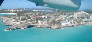
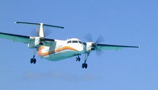
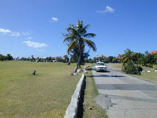
1: One of my arrivals in St. Martin. As I island hopped I arrived via WinAir three times. Down below is the Maho Beach Resort at the airport.
2: A view back at Philipsburg on my way up to Fort Amsterdam.
3: Another view back at Philipsburg on my way up to Fort Amsterdam.
4: Fort Amsterdam.
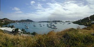
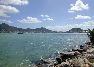
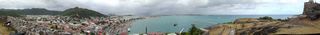
5: A view of Great Bay from Fort Amsterdam.
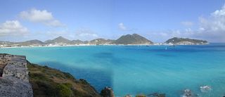
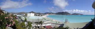
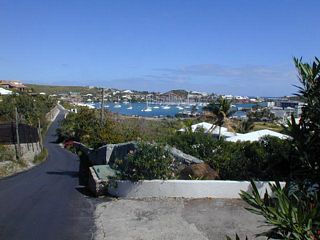
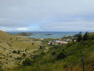
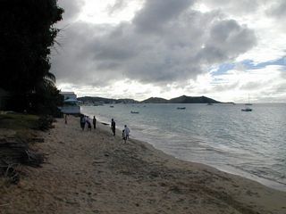
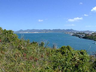
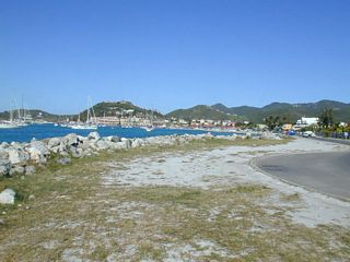
6: Looking at Philipsburg, with the Great Salt Pond before it. Taken from the road to Guana Bay.
7: Looking at Philipsburg, with the Great Salt Pond before it. The same view as the previous, but now in the morning.
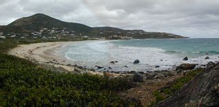
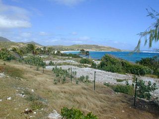
8: Looking down at Guana Bay.
9: Guana Bay.
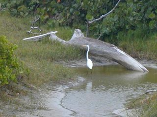
10: A Great White Heron.
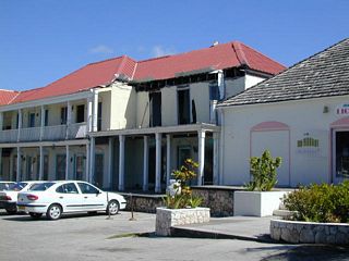
11: Above Dawn Beach. With the remains of the old Dawn Beach Hotel, destroyed by Hurricane Luis in 1995.
12: Above Dawn Beach looking in the other direction. Babit Point is sticking out. A little sliver of Oyster Pond is to the left.
13: Oyster Pond.
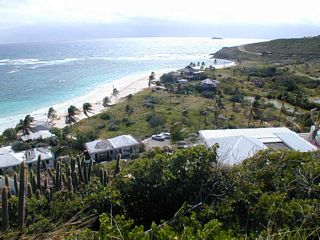
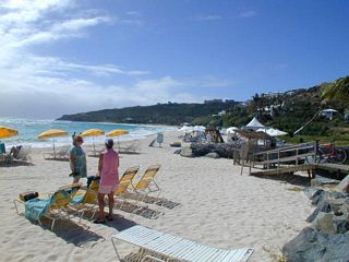
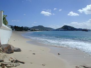
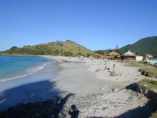
14: Dawn Beach. See my bike to the right.
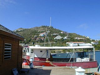
15: In the marina in Oyster Pond.
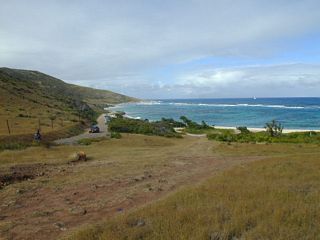
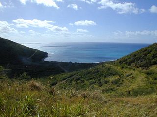
16: Oyster Pond.
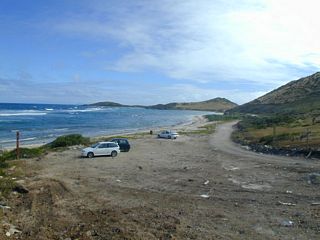
17: Looking towards Baie Lucas.
18: Looking back at Baie Lucas. With Babit Point sticking out.
19: Baie de l'Embouchure.
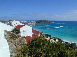
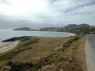
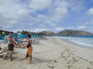
20: Baie de l'Embouchure. Taken from the viewing stand.

21: Orient Beach. Looking south.
22: Orient Beach. Looking north.
23: Northern end of Orient Beach between Mont Vernon and Esmeralda, looking south. Green Key is off to the left, and the rock pile near Coco Beach is on the right.
24: Grand Cayes. As you first reach it.
25: Grand Cayes. Standing at the dump and looking back.
26: From Pigeon Pea Hill looking down on Etang de la barrière.
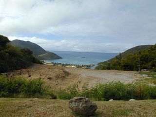
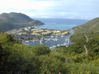
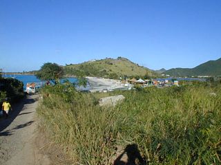
27: From Pigeon Pea Hill looking down on Anse Marcel.
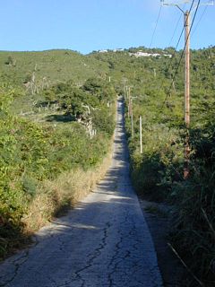
28: Looking down on the Marina in Anse Marcel.
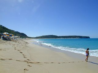
29: This is the road I had to bike down to get to the Marina. And walk up.
30: The beach in Grand Case.
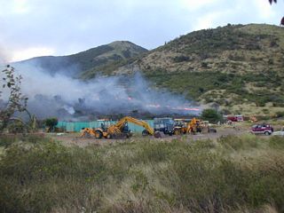
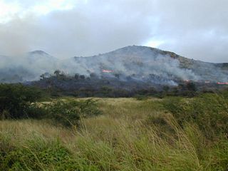
31: From Mont Vernon looking towards Orient Beach.
32: On my way back to Philipsburg I came across a brush fire.
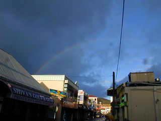
33: The brush fire again.
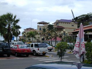
34: The next morning in Philipsburg I find a rainbow.
35: Looking back at Philipsburg.
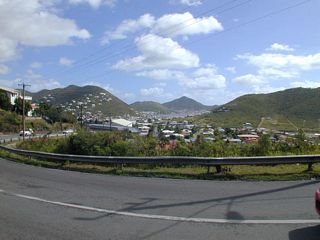
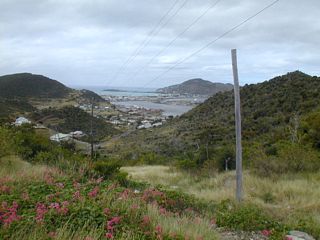
36: Looking down at Cay Bay.
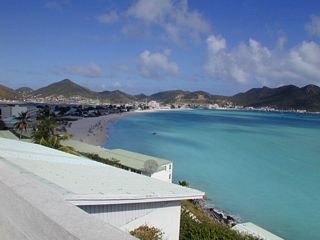
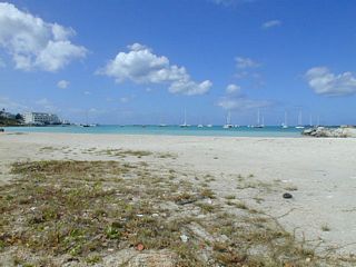
37: Looking down at the town of Cole Bay. Simpson Bay Lagoon is behind.
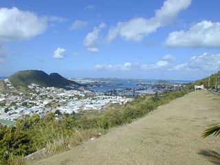
38: Kimsha Beach, a small man made extension to Simpson Bay Beach located between the Royal Palm and Atrium Resorts. At the east end of Simpson Bay. Looking out at Simpson Bay.
39: Simpson Bay Lagoon. Taken from across the street from the end of the runway.
40: Simpson Bay looking west. From the strip of land at the far side of the airport runway.
41: Simpson Bay looking east.
42: There is a road at the end of the runway. You can watch planes fly over you.
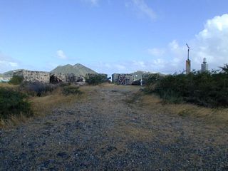
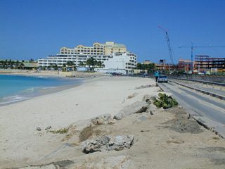
43: The road at the end of the runway looking towards Maho Bay.
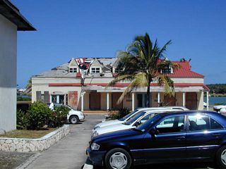
44: Mullet Bay Resort. Damage from Hurricane Luis in 1995 still hasn't been repaired.
45: Mullet Bay Resort. Damage from Hurricane Luis in 1995 still hasn't been repaired.
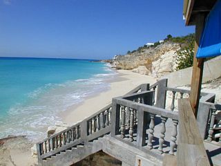
46: Mullet Bay Resort.
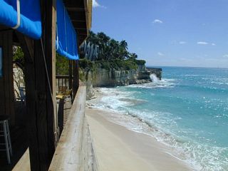
47: From Cliffhanger Beach Bar in Cupecoy Beach. Looking east.
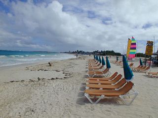
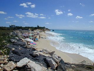
48: From Cliffhanger Beach Bar in Cupecoy Beach. Looking west.
49: Cupecoy Beach, further out. This is a nudist beach.
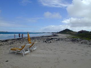
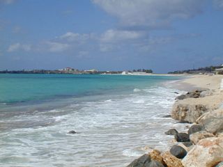
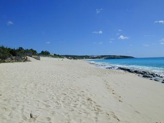
50: Simpson Bay Lagoon from Cupecoy.
51: Long Bay looking east.
52: Long Bay looking west.
53: Baie Rouge.
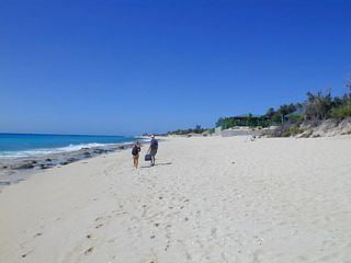
54: Coming into Marigot from the south.
55: Friar's Bay.
56: Friar's Bay.
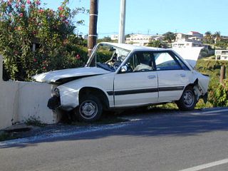
57: A crippled car along the side of the road. Near Cripple Gate.
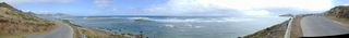
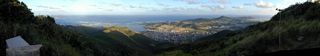
58: Looking down the road that leads up to the top of Colombier. I locked up my bike and hitched up.
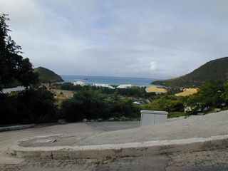
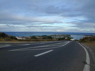
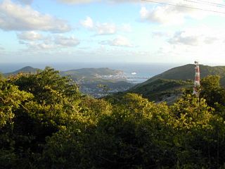
59: A good panorama from the top of Colombier looking east. Orleans is the town below.
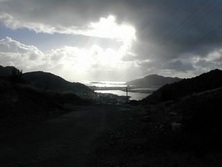
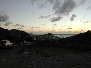
60: From the top of Colombier looking towards Philipsburg.
61: It's getting dark on my way back. From Union Road looking south towards Simpson Bay Lagoon. Taken near the boundary mounument.
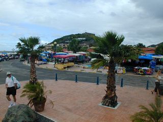
62: A lovely panorama of Marigot from Fort Louis. In the center is the ferry to Anguilla boarding people.
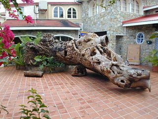
63: The souvenir stands in Marigot.
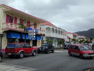
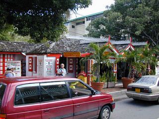
64: A tree found in a courtyard in Marigot.
65: A street scene in Marigot.
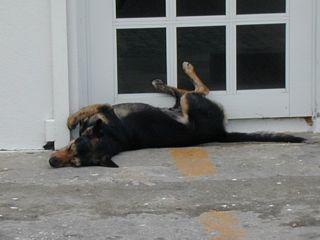
66: Another street scene in Marigot.
67: A sleeping dog.
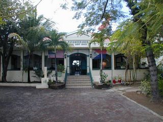
68: Guavaberry World Headquarters in Philipsburg.
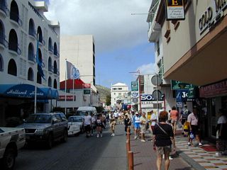
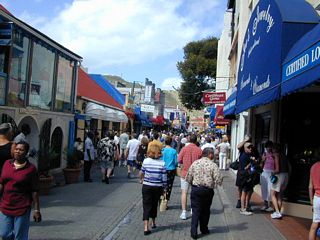
69: Pasanggrahan Royal Guest House. Where I had dinner one night.
70: A Front Street scene in Philipsburg. The cruise ships are in.
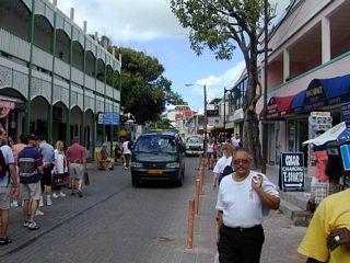
71: Another Front Street scene in Philipsburg.
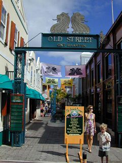
72: Another Front Street scene in Philipsburg.
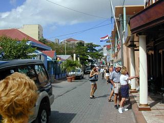
73: Old Street in Philipsburg.
74: Another Front Street scene in Philipsburg.
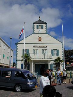
75: Another Front Street scene in Philipsburg.
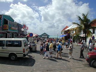
76: The Old Courthouse at Wathey Square.
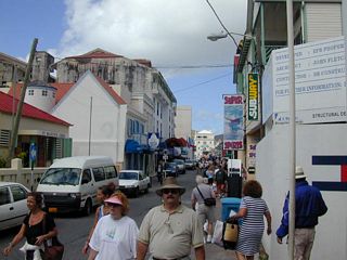
77: Wathey Square. This is where they land the cruise ship passengers.
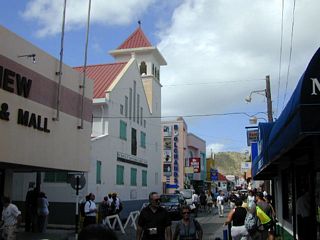
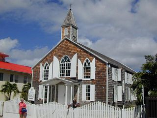
78: Another Front Street scene in Philipsburg. Lots of cruise ship passenegrs.
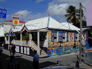
79: The Methodist church in Philipsburg.
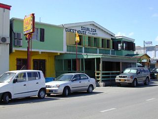
80: L'Escargot Restaurant. See painted snails.
81: The Soualiga Guest House is where I stayed.
© Don Wiss 2002-2026. All rights reserved.