A panorama of Long Bay.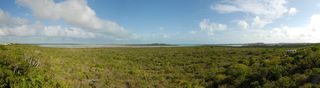 A panorama at Turquoise Ridge.
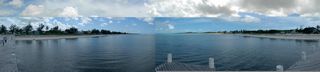 A panorama from a dock along Blue Hills Road. At [??]. The duplicate boy can be eliminated, but I haven't spent the time figuring out how.
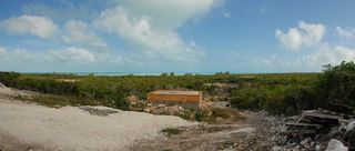
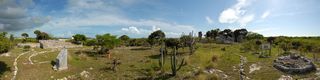 A panorama of the Cheshire Hall ruins.
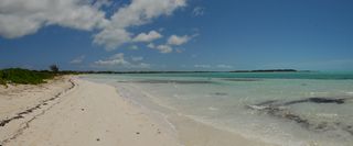 A small panorama of the beach behind the Five Cays Community Center. Looking north into Five Cays Bay.
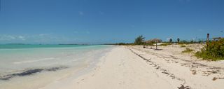 A small panorama of the beach behind the Five Cays Community Center. Looking south at the Five Cays.
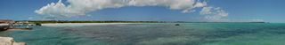 A panorama of Five Cays Bay from Stubbs Creek Point.
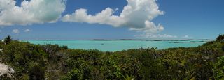 A panorama of Chalk Sound. Taken a little ways after Chalk Sound Road starts and I'm looking north.
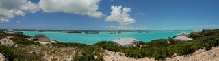 Another panorama of Chalk Sound. Also looking north.
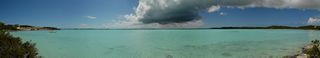 A panorama of Chalk Sound from off South Dock Road.
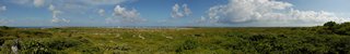 A panorama from the top of Taylor Hill looking at the Town Salinas and Balfour Town.
 Another panorama from the top of Taylor Hill looking at the Town Salinas and Balfour Town. This with a more zoomed out lens.
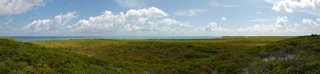 A panorama from the ridge inland from Little Bluff Lookout looking at the North Beach with Windmills Plantation [closed after Hurricane Ike in 2008] off to the right.
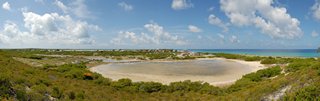 A panorama from the ridge inland from Little Bluff Lookout looking at town with the [name?] pond in front. Behind is an overly tall house built by an owner that used trickery to get it approved.
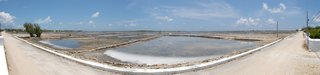 A panorama of the Town Salinas. Taken standing just north of St. John's Anglican Church. Taylor Hill is the bump in the distance.
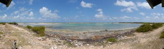 A panorama from the South Creek Bird Sanctuary viewing platform. I saw no birds here.
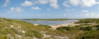 A panorama of Grey Salina.
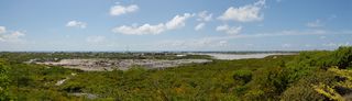 A panorama from the top of Colonel Murray's Hill. The highest point on the island. This was the location of the US missile-tracking station, now a ruin. Of course, with the dump in front, this view isn't the prettiest.
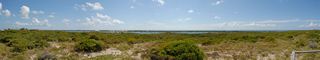 A panorama from a platform along Lighthouse Rd. This is the future site of the Sailview Resort [never built]. Looking west over North Creek.
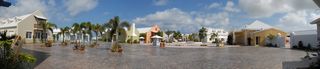 A panorama of the plaza at the cruise ship center. This "tourism village" was designed to look like a Bermudian salt-rakers' settlement from the early 19th century. No cruise ship this Tuesday.
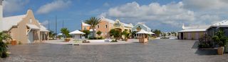 Another panorama of the plaza at the cruise ship center. This one with the Jimmy Buffett Margaritaville, his largest. I gather some cruise ship passengers simply spend their entire day on the island in the Margaritaville and this complex.
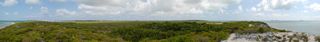 A panorama from Gun Hill. This is the second highest elevation on Grand Turk. In the early 1780s a small fortification with two cannons was built at this site by the English governor for protection against French invasion. The French did not attack immediately and the fort was dismantled. Most of the rocks were taken away for use in other building projects on the island, though the foundation rocks can still be seen.
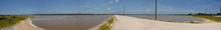 A panorama of Great Salina. I did not go across to what would be the South Creek National Park. It looked kind of industrial. I later learned that the building in the distance is "Sitting Pretty" H.M.S. Prison, and the national park is behind it.
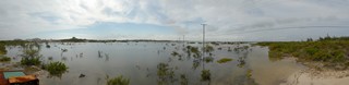 A panorama from atop a crane by East Bay. As you can see all the salinas are flooded. You can see telephone poles and no road. This has been a week since the rain and it has gone down some. (See higher level marks along right.) Atop the highest hill is the old commissioner's house.
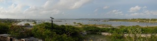 A panorama of the flooded salinas from the old commissioner's house. The yellow crane I was standing on is off to the far right. To the left of this picture is the town, which the sun was directly over.
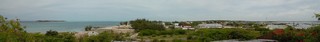 A morning panorama from the old commissioner's house looking over the town of Cockburn Harbour. This taken at 8:30 when the sun was favorable.
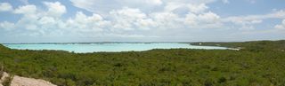 A panorama from beyond the airport looking south at Chalk Sound.
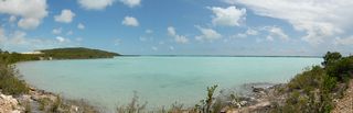 Another panorama from beyond the airport looking south at Chalk Sound.
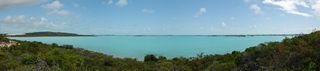 Another panorama from beyond the airport looking south at Chalk Sound.
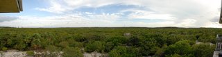 A panorama from outside my bedroom window in the Crosswinds villa [archive.org]. Looking south at 5:10 in the afternoon. The area with houses dotted in the distance is the hamlet of Bambarra.
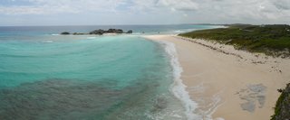 A small panorama of Mudjen Harbour. Looking from above.
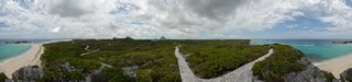 A 360° panorama from the hill at Mudjen Harbour. The buildings dotted about are the cottages and villas of the Blue Horizon Resort, which covers 50 acres.
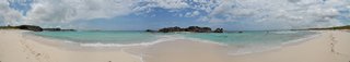 A panorama of Mudjen Harbour. Standing on the beach. When the tide is low you can walk out the spit of sand and get to Dragon Cay.
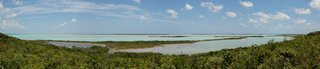 A panorama looking out over Bottle Creek. Conch Cay and Blue Cay are the larger islands. I was where the road makes a bend to the west in Ready Money.
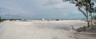 A panorama of the North Caicos Yacht Club & Marina in Sandy Point, a 153 acre canal and beach front subdivision. At the left are people arriving by boat from Provo and men picking them up.
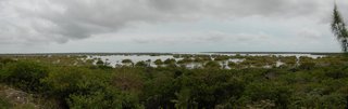 Flamingo Pond in the late afternoon. It is high tide. I was told I would see flamingos. Not only did I not, I never saw any on this trip.
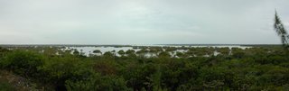 A morning panorama of Flamingo Pond.
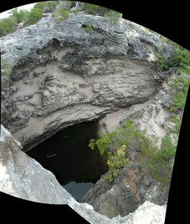 I'm now back on Provo for my third time. This is The Hole (a deep water hole) on Sea Sage Hill Road in Long Bay Hills. To get it wider I stitched together two pictures. Note the difference with the deep fresh water blue hole I found on wetter North Caicos, which is full of water.
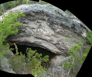 Another of The Hole. This is three pictures stitched.
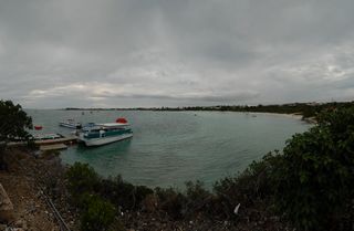 A panorama of Sapodilla Bay from above the dock for the boats to West Caicos.
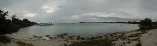 A panorama of Sapodilla Bay from the beach.
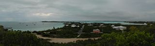 A panorama of Sapodilla Bay from Sapodilla Hill. This one gets Chalk Sound on the right.
© Don Wiss 2007-2026. All rights reserved.